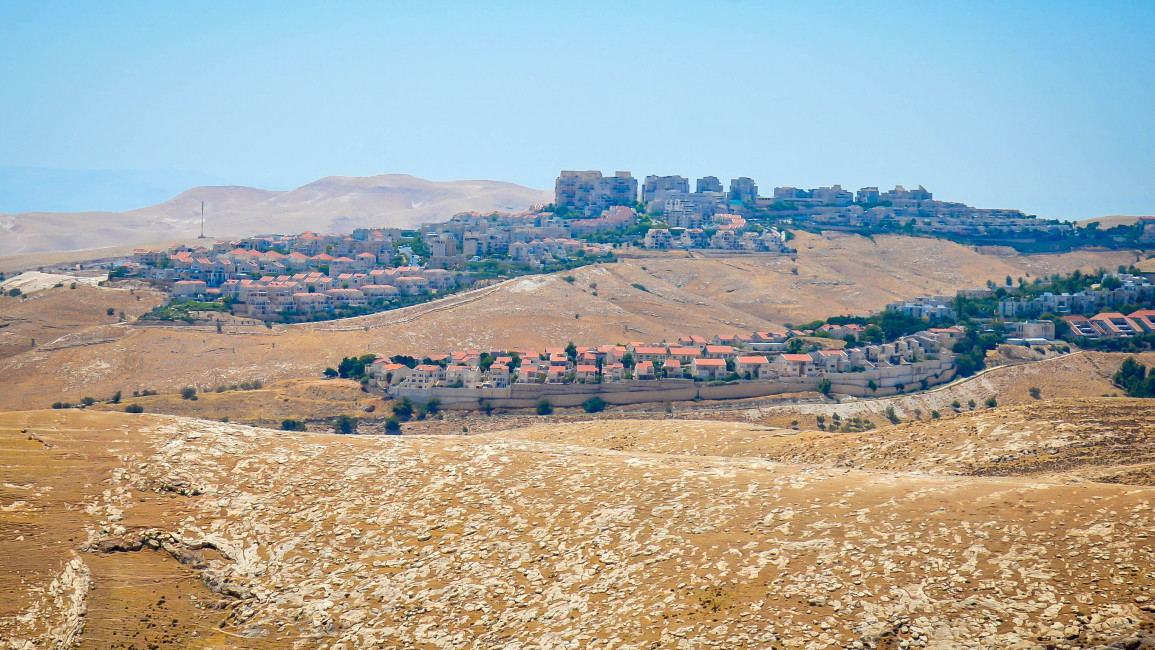
Israeli settlers plan the largest 'national park' on Palestinian land since 1967
The largest Israeli confiscation of Palestinian land in years "can very possibly take place" said a Palestinian expert after settler leaders in the West Bank announced a "national park" proposal, as reported by the Israeli press earlier this week.
The plan covers the space between the east of Jerusalem and the Dead Sea, effectively confiscating one million dunams (1,000 Km2) of Palestinian land currently classified as "Area C", which is under direct Israeli military control.
According to the Israeli press, the "ambitious" plan will include, among other things, "a network of mobile restaurants, the establishment of a hotel complex in the North Dead Sea, a joint information and reservation centre and more".
Israeli occupation authorities are planning to build a new national park on nearly 1 million dunums of Palestinian land in the occupied West Bank between occupied Jerusalem and the Dead Sea. pic.twitter.com/7eKFnZixuN
— PALESTINE SUNBIRD 🇵🇸 (@SBPal_Eng) June 13, 2022
"This is a strategic area for the Israeli settlement project," Khalil Tafakji, a leading Palestinian expert on Israeli settlements and maps researcher, told The New Arab. "It would mean expanding Israel's settlements all the way to the Jordanian border, cutting through Palestinian land."
Israeli reports indicated that the planned project also aims at settling in the E-1 area to "breach the gap between Samaria and Judea", the Israeli terms for the North and the South of the West Bank.
The "E-1" block east of Jerusalem is a 12 Km2 area, home to dozens of Palestinian Bedouin communities. Israel has designated the area for settlement plans since 2009.
"This means cutting the Palestinian demographic continuity in the West Bank in half," Tafakji pointed out, "it also means the displacement of thousands of Bedouins out of their lands."
"Although it is still a settler plan, it has a real potential of being adopted by the government," he further noted.
"It wouldn't be strange to see the plan officialised, as settler-made plans have been officialised in the past," he added. "The area is already seen as a settlement expansion space by the state 2020-2050 plan."
The "Israel 2020-2050" master plan was launched in 2019, with the stated aim of creating "a competitive and thriving economy" as well as seeking advances in the climate change field, as announced by the Israeli government.
Judea and Samaria leaders have announced a plan for the establishment of a new national park on nearly 1 million dunams (247,000 acres) of land between Jerusalem and the Dead Sea. https://t.co/Dssqto2X7g
— Cleveland Jewish News (@CleveJN) June 13, 2022
However, Palestinian observers insist that the plan includes "further colonisation of Palestinian land under environmental and development guise," as Jamal Jumaa, coordinator of the Stop The Wall campaign said to The New Arab.
"The 2020-2050 plan includes the area designated for the national park in the settlers' proposal, which is entirely in Palestinian lands," Jumaa said. "The plan includes building an airport, residential areas and entirely new Israeli cities."
"If the reported natural reserve plan is adopted, it would mean that the land is officially confiscated. Once it's done, the lands' use can easily change in the future, from a natural park to whatever the master plans read," he added.
The proposed plan includes covers lands belonging to Palestinian towns like Abu Dis, Sawahrah Sharqiyah and Aizariyah.
For a map of the 790 East Jerusalem settlement units in tenders published today, see: There are 400 more in West Bank pic.twitter.com/6i3FwXbrVW
— Daniel Seidemann (@DanielSeidemann) August 11, 2013
"Israeli settlement expansion is already blocking Aizariyah like handcuffs," said Khalil Abu Rish, mayor of Aizariyah, located just outside Jerusalem to the east, overlooking the Jordan Valley.
"Aizariyah's lands include 12,000 dunams, of which only 500 remain available for the town to expand on," he explained. "The rest has been confiscated for the benefit of Israeli settlements."
"The town is overcrowded today, with building being only possible upwards, adding stories," the mayor said.
"The settlement projects we are facing now include blocking our eastern exit towards the Jordan Valley and making us an alternative road to the north. This shows that plans are made to build more settlement units on our land," he added.
Settlements are fucking UGLY. this is Maale Adumim, the #1 largest settlement in Palestine, and it somehow looks like an actual tumor. who the fuck designed it pic.twitter.com/9xgmZzk7XI
— #Nakba74 ☭🇵🇸 (@Marxozoic) June 24, 2021
The plan arrives only days after far-right Israeli lawmaker Bezalel Smotrich proposed a bill for declaring Israeli sovereignty over the West Bank.
Earlier in June, Israeli media reported that settler leaders were planning 10 new settler outposts across the West Bank, ahead of the US president Joe Biden’s visit to Israel. The visit, previewed for June, was postponed for July.


![President Pezeshkian has denounced Israel's attacks on Lebanon [Getty]](/sites/default/files/styles/image_684x385/public/2173482924.jpeg?h=a5f2f23a&itok=q3evVtko)


 Follow the Middle East's top stories in English at The New Arab on Google News


